 Guy Bar-Oz, of the Zinman Institute of Archaeology and Head of the University of Haifa - Department of Archaeology, has assembled a team of archaeologists and specialists in bio-archaeological research, including aDNA, Stable Isotope Analysis, Palaeobotany, Archaeozoology, Geoarchaeology and Chronometry to tackle a century old question regarding the rise and fall of the Byzantine settlements in the Negev Desert of Israel. Nearly 1,700 years ago, human ingenuity and imperial capital allowed the Byzantines to undertake a project of ‘greening of the desert’ within the marginal arid Negev region, almost two millennia before a similarly grand achievement was made possible due to the major advantages conferred by modern technology. Within only four and a half centuries much of the urban infrastructure and its expansive agricultural hinterland developed by the Byzantines was abandoned or experienced major population decline, giving rise to a long unresolved double conundrum in archaeological research: what were the underlying factors leading a complex urban society to flourish on the edge and, especially, what were the causes for its eventual demise.
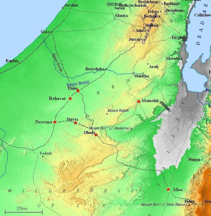
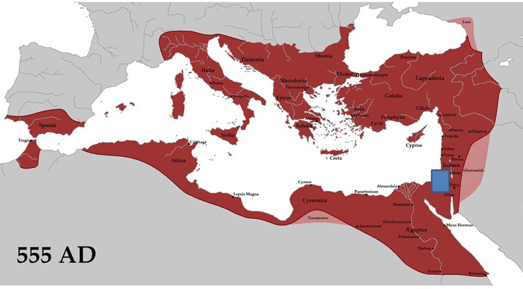
The above maps show the location of the Negev within the Byzantine Empire at its greatest extent in the 6th century AD, the Justinian period, and of the Byzantine settlements of the Negev (source: http://www.biblewalks.com/sites/Shivta.html).
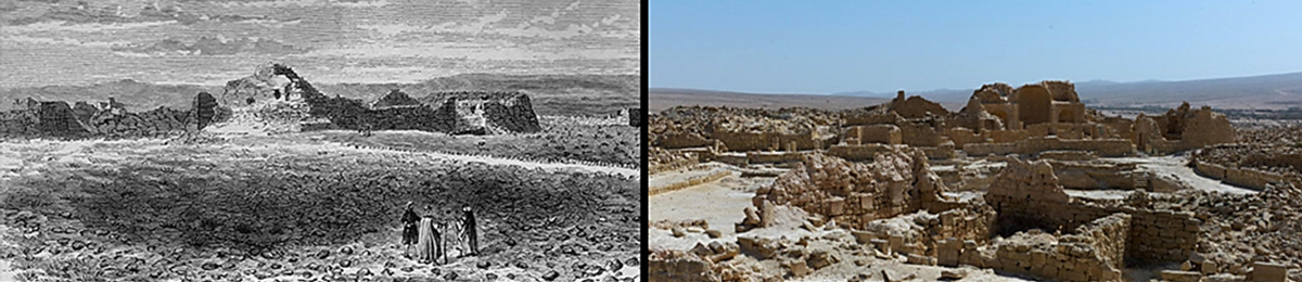
The photographs on the right show a sketch of the Byzantine town of Subeita (Shivta) in the Negev Desert drawn by Edward H. Palmer nearly 150 years ago (left) and a modern day photo of the same section of the town (right).
As modern societies are rapidly evolving into technologically-advanced their systems of institutions and administrations become increasingly complicated and consequently concerns about the continued sustainability of humankind are growing. Research on the collapse of complex societies was recently popularized by Jared Diamond, drawing on such well-known historical examples from ancient Mesopotamia, Easter Islands and Greenland where human-led environmental degradation may have instigated their demise.
Numerous other studies on the issue have, nonetheless, emphasized the fact that ancient complex societies often emerged in the form of loosely-coalesced political institutions, giving rise to inherently unstable systems. Ancient societies were also vulnerable to unpredictable historical events as large-scale warfare, outbreaks of plague and the vagaries of climate change. Particularly in regions with marginal and limiting environmental conditions such as drylands, inherent societal vulnerabilities can interact with unsustainable human development to undermine the integrity of even the most advanced systems of the time. Examples of how societies in the past failed or demonstrated resilience in the face of different forms of crisis provide us with invaluable lessons for our future.
 Discovery of the seven known Byzantine settlements of the Negev: Elusa (Haluza), Subeita (Shivta), Oboda (Avdat), Nessana (Nitzana), Mampsis (Mamshit), Ruheibeh (Rehovot-in-the-Negev) and Khirbet Sa’adon began by early modern explorers more than 150 years ago and has continued to baffle archaeologists, historians, geographers and palaeo-climatologists to this day. Over the years researchers have explored a wide range of causal factors in an attempt to explain the Byzantine florescence and decline in the Negev, including issues of climatic fluctuations, historical developments (rising importance of Christianity in the Holy Land >300 AD and the Islamic conquest of 640 AD), and the spread of the Justinian Plague in the mid-6th century AD. A new approach to this old problem will now be deployed by the University of Haifa project based on intensive retrieval of bio-archaeological data from contexts of everyday life in the ancient towns (e.g., municipal landfills, the floors of sealed houses and agricultural installations and palaeo-fields). Pilot excavations at the site of Elusa began in February 2015 and are scheduled to resume in the fall of this year.
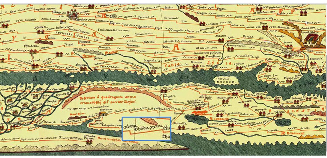
The above figure presents a section of the Peutinger Map (Tabula Peutingeriana), showing the location of the Byzantine town of Oboda (Avdat) in the Negev on a 13th century copy of a 5th or 4th century roadmap of the Roman Empire.
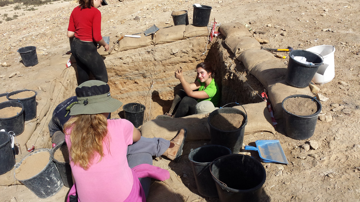
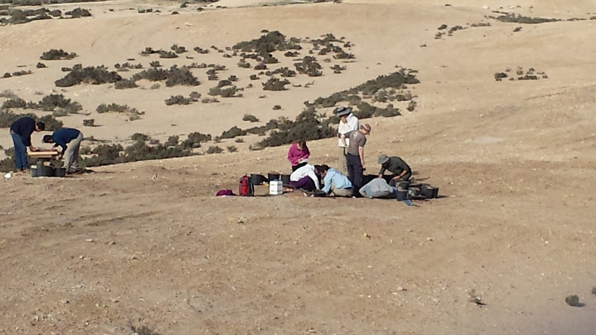 Sieving and digging operations at the Halutza ancient landfills during February 2015 are shown in these photographs.